November 2015—Despite a lack of electricity or running water, nine communities in Papua New Guinea’s Almami area of Madang province are taking charge of their environment and providing an example to other communities and their government on climate change adaptation and mitigation.
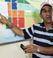
Together with USAID’s Lowering Emissions in Asia’s Forests project and The Nature Conservancy, these communities encompassing 18,000 hectares (44,500 acres) have implemented participatory land use planning. All villagers take part in zoning their community land for specific uses: agriculture, conservation, forest use, gardening, hunting and village development.
Following the path and passions of their ancestors, the Urumarave people make their home atop a granite peak in the country’s Adelbert Range. Isolated, surrounded by dense forest, this village is a nine-kilometer trek to the nearest paved road. The community’s 300 inhabitants come from three different tribes and collectively manage 1,100 hectares of land.
“There are social benefits to this planning process,” said Andrew Basebas, the son of an Urumarave tribal chief. “It teaches young people discipline and they learn to respect and want to preserve the environment. As a community that’s lived here for eight generations, we are confident that today’s youth will continue to be good stewards of these lands.”
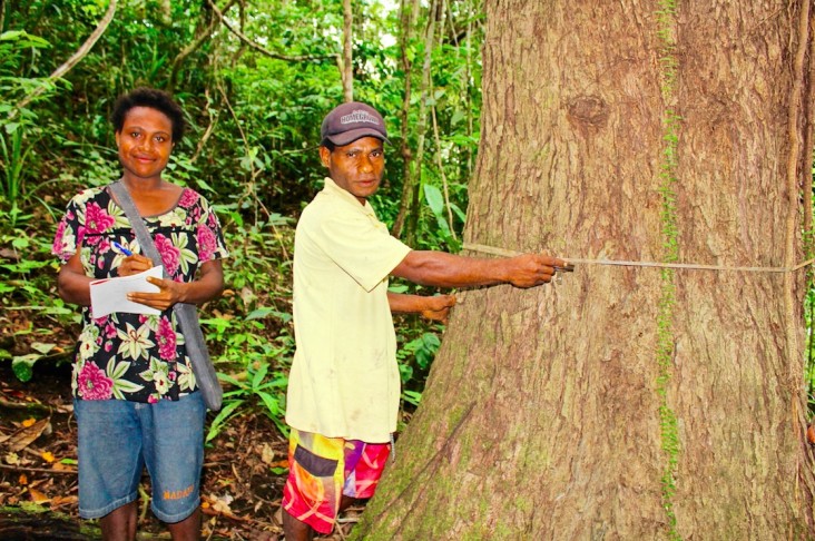
In 2014, USAID conducted the first forest biomass assessment training in Urumarave, where residents learned to measure trees to determine the amount of carbon sequestered in the forests. Excessive forest clearing has released massive amounts of stored carbon, causing erosion, landslides and other effects that will immediately impact their way of life.
Estimating the amount of stored carbon is essential to understanding how much carbon dioxide would be released into the atmosphere were the forest to be disturbed or destroyed through fire, logging or clearing for agriculture. Armed with this knowledge, villagers can protect existing forest and are planting trees in degraded areas.
Basebas says villagers respect land use planning because it helps preserve the ways of their ancestors who had high regard for the cultural, ecological and spiritual significance of the land.
“The forest is the life we are attached with,” he said. “In the past—with non-sustainable hunting and gardening, plus excess logging—the trees and wildlife disappeared. Now, species are flourishing, and wildlife is coming back. Seeing these return have modernized and strengthened the village.”
There have also been benefits to the agricultural practices of the Urumarave people, who grow nearly everything they consume, and trade or sell excess produce. Through technical assistance and training, villagers have set aside plots of land specifically for gardening on land less susceptible to erosion and landslides. They practice “intercropping,” or growing two or more crops in proximity, to increase food production while using less land and water.
USAID, using the global dataset from the University of Maryland, has found that community conservation agreements based on participatory land use plans reduce forest clearance by up to 50 percent compared to communities that do not have a land use plan. USAID is also working with communities across the Adelbert Range to better understand the drivers of deforestation and degradation.
The magistrate of the neighboring Wagedave community, Nicolas Dilol, says he is inspired by the benefits demonstrated by Urumarave’s land use planning process. “If our villages here in the forest can adopt measures to preserve and protect the environment for our children and future generations, then anyone should be able to do it.”
The Lowering Emissions in Asia’s Forests project, which runs from 2011 to 2016, is designed to reduce greenhouse gas emissions from the forest sector in six target countries: Thailand, Laos, Vietnam, Cambodia, Malaysia and Papua New Guinea.
LINKS
Follow @USAIDAsia, on Facebook, on Flickr, on YouTube


Comment
Make a general inquiry or suggest an improvement.